A 3D model may look like a complete digital copy of a physical object, but the information used to create it often begins in a much simpler form. Before surfaces, colours, and detailed geometry appear, a scanning system may collect thousands or even millions of individual points in three-dimensional space. Together, these points form what is known as a point cloud.
If you have ever wondered what is point cloud data is and why it matters in modern design, surveying, manufacturing, and digital documentation, the easiest way to understand it is to imagine rebuilding an object using tiny digital markers. Each marker records a position in space. When enough of them are collected, their arrangement begins to describe the shape of the original subject.
A Digital Collection of Positions
A point cloud is a group of individual data points representing the surface or structure of a physical subject. Each point has a position defined by three coordinates: X, Y, and Z. These coordinates describe where that point exists along three spatial directions. Depending on the scanning equipment and software, points may also contain additional information. Some datasets include colour values, intensity readings, or other measurements that help describe the captured environment.
Imagine scanning a decorative chair. The system records points across its legs, seat, backrest, and other visible surfaces. Viewed together, these points create a digital representation of the chair’s overall shape. However, the individual points are not solid surfaces. They are separate measurements. The software must interpret their arrangement before producing a connected model with visible faces and edges.
How Does Scanning Produce Point Cloud Data?
Different technologies can generate point clouds, but the basic idea is to collect spatial information from a physical environment. A laser-based scanner sends light toward a surface and measures the returning signal to estimate distances. Other scanning technologies use structured light or infrared sensing to capture depth information. Photogrammetry can also generate point clouds by calculating spatial relationships between overlapping photographs. As the equipment captures different parts of an object, it records additional points. Several scans may be required to cover areas that are hidden from the initial position.
For example, when documenting a vehicle, one capture may record the front and one side, while additional passes cover the rear, roof, and remaining surfaces. The separate datasets can then be aligned into a common coordinate system. The result is a collection of spatial measurements that can be inspected and processed using compatible software.
Why Millions of Points Do Not Automatically Mean a Better Model
It may seem reasonable to assume that a dataset containing more points must always be more useful. In practice, that is not necessarily true. Point density refers to how closely the individual points are distributed across a captured surface. Higher density can preserve smaller details, but it also increases the amount of data that needs to be stored and processed.
The ideal density depends on the task. A broad architectural survey may not require the same level of detail as a small mechanical component. Capturing excessive information can make software slower without providing meaningful benefits to the final project. Accuracy is another separate consideration. A dense point cloud can still contain errors caused by poor alignment, movement, reflective surfaces, or limitations in the scanning equipment. A large dataset is only valuable when its measurements are sufficiently reliable for the intended use.
From Raw Points to a Finished Digital Model
A point cloud is often an intermediate stage rather than the final deliverable. To make the information more practical, users may need to complete several processing steps. The first task is usually alignment. When multiple scanning sessions have been performed, their point clouds must be positioned correctly so that the captured sections form a consistent representation. Next comes cleaning. Unwanted points may come from the background, moving objects, nearby equipment, or accidental captures. Removing these areas helps isolate the subject.
Depending on the project, the cleaned data may then be converted into a polygon mesh. A mesh connects vertices to create surfaces, making it possible to display the object as a more conventional 3D model. Additional editing may be needed to close gaps, correct geometry, or simplify the model. For engineering applications, the workflow may continue into CAD software, where designers use the scan as a reference for creating editable geometry. A mesh and a CAD model are not the same thing, so additional reconstruction is often necessary.
Where Point Clouds Make a Practical Difference
Point cloud technology is useful wherever understanding the shape or position of physical objects matters. To understand what is point cloud data is and how it is applied, consider its role in construction, where professionals can document existing buildings and compare captured conditions with design information. This can help identify differences between planned and actual structures. Manufacturers use scanning data to inspect components, examine dimensional variations, and support reverse-engineering projects. A physical part can be captured digitally and studied before a replacement or revised design is developed.
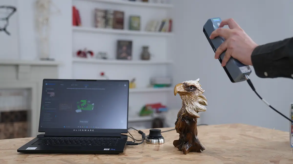
In cultural preservation, detailed spatial records can help document sculptures, monuments, and historic structures. These records provide information that can be revisited even when direct access to the original object becomes difficult. The same technology also supports product design, automotive development, digital art, and virtual environments. Dedicated scanning equipment from manufacturers such as EINSTAR can help users collect the spatial data needed for these workflows, depending on the requirements of the subject and application.
Choosing Software and Storage for Large Datasets
Point clouds can become surprisingly large, particularly when they contain detailed captures of buildings, machinery, or outdoor environments. This makes software compatibility and storage planning important parts of the workflow. Before selecting a processing application, check which file formats it supports and whether it can handle the size of the datasets you expect to create. Some applications are designed for viewing and measuring point clouds, while others provide tools for registration, cleaning, meshing, and CAD-related work. It is also sensible to keep an untouched copy of the original scan. Processing may involve removing points or changing the dataset, and retaining the original makes it easier to return to earlier information if corrections are needed.
Final Thoughts
Point clouds provide the spatial information behind many modern 3D capture workflows. By collecting individual coordinates across physical surfaces, scanning systems create datasets that can be aligned, cleaned, measured, and converted into more complete digital models. Their usefulness depends on more than the number of points collected. Accuracy, density, software compatibility, and the final application all influence the value of the data. Once these basics are understood, point clouds become much easier to interpret and use in practical projects.
Frequently Asked Questions
What is a point cloud in simple terms?
A point cloud is a collection of individual points in three-dimensional space. Together, these points describe the shape or structure of a physical object or environment.
Is a point cloud the same as a 3D model?
No. A point cloud contains separate spatial measurements, whereas a polygon-based 3D model connects vertices to create surfaces. Point cloud data can be used to generate a mesh or support further modelling.
Can point cloud data be used for 3D printing?
Yes, but it generally needs to be processed first. The data may need conversion into a mesh, repair of missing areas, and checks to ensure the resulting geometry is suitable for printing.
What determines point cloud accuracy?
Accuracy depends on the scanning technology, calibration, distance, surface properties, capture conditions, and alignment of multiple scans.
Why do point clouds contain so many individual points?
A large number of points helps represent surface geometry in greater detail. The required quantity depends on the object’s size, complexity, and the level of detail needed for the project.
Also Read-How Technology Is Helping Creators Experiment With New Visual Styles